| AMRIT / AMURRE Founded by Amorite colonists from Arvad in the late third millennium BC, Amrit was a town in the modern Latakia Province which was situated 50km (30 miles) to the north of Tripoli. Initially under the authority of Arvad, like the rest of the region, it saw a procession of various peoples and powers, including Canaanites, Phoenicians, and the great empires of the first millennium BC.
By the time Alexander the Great annexed the region to his Greek empire. Amrit was one of the biggest cities in the ancient world. At least until the first century BC it apparently played an important role, with coins being minted here. Today it houses the remains of the only well-preserved Phoenician temple in the world, the Temple of Amrit.
c.1600 - 1100 BC : Under Arvad's authority.
1100 - 625 BC : Amrit is conquered by Assyria.
625 - 604 BC : Under Arvad's authority.
604 - 539 BC : Amrit is conquered by Babylonia.
Sarepta :
This was a Phoenician city which spent much of its existence under the control of Sidon (eight miles to the north). It was first mentioned in Egyptian records in the fourteenth century BC, and the Old Testament comments on it being subject to Sidon during the reign of the Samarian king, Ahab (870-848 BC). There it is called Zarephath. By the first century AD the Roman port of Sarepta existed about a kilometre to the south (as mentioned by Josephus). The city survived until at least the fourteenth century AD, after the collapse of the Crusader kingdoms in the area.
(Additional information from Jewish War & Jewish Antiquities, Flavius Josephus.)
Amrit as per Wikipedia :
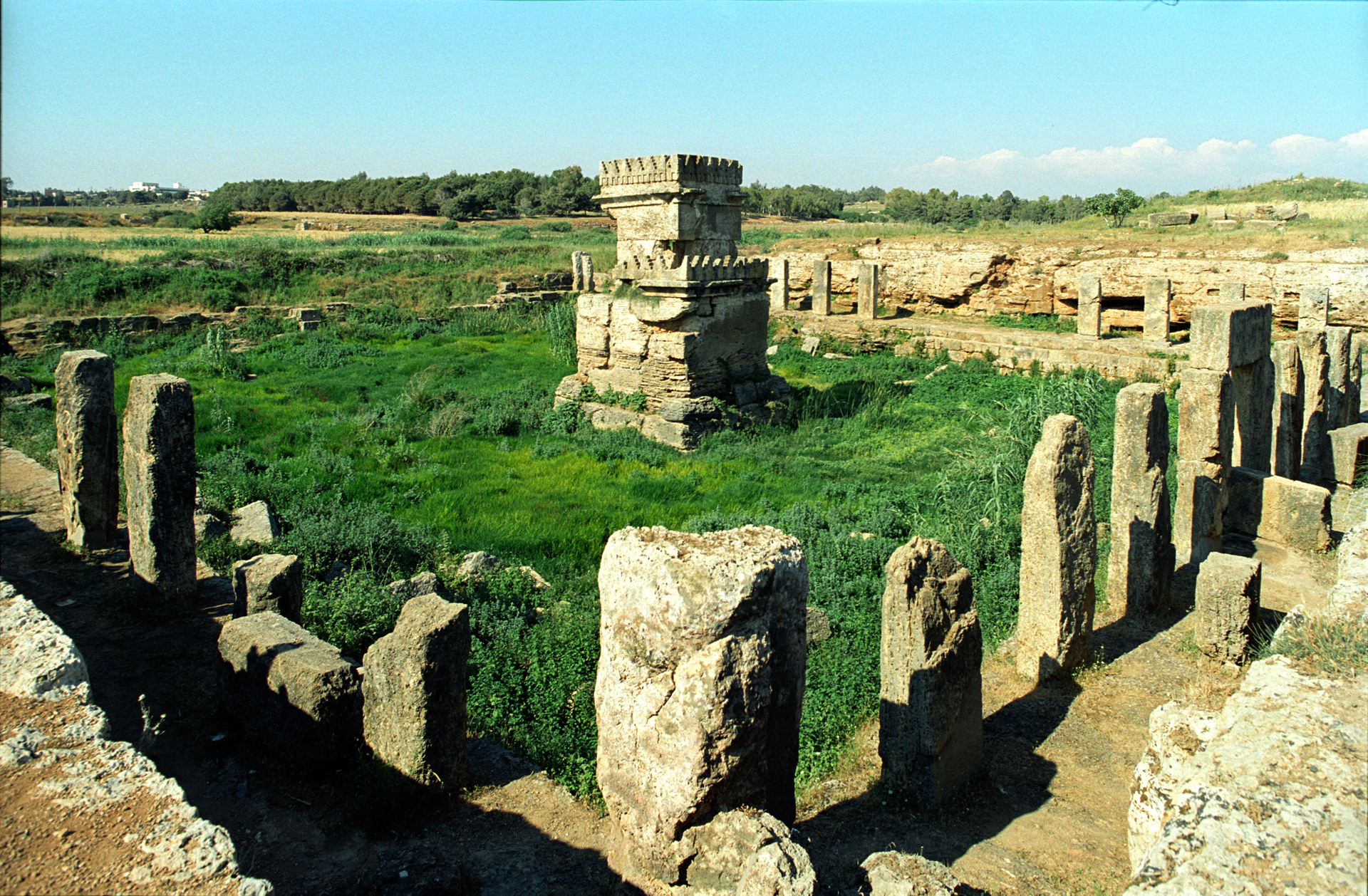
The Temple of Amrit (Click on image to enlarge)
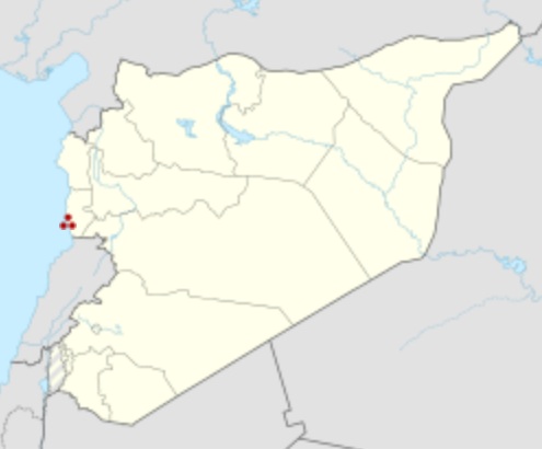
Amrit Shown Within Syria in Red Dots Alternative
name : Amrith, Marathus, Marathos
Type
: Settlement
Amrit, the classical Marathus (Greek: Marathos), was a Phoenician port located near present-day Tartus in Syria. Founded in the third millennium BC, Marat (Phoenician: mrt) was the northernmost important city of ancient Phoenicia and a rival of nearby Arwad. During the 2nd century BC, Amrit was defeated and its site largely abandoned, leaving its ruins well preserved and without extensive remodeling by later generations.
History
:
Excavation
:
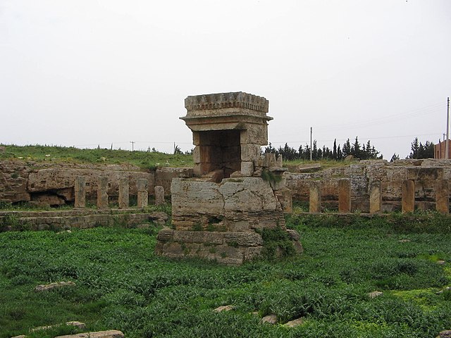
Temples
:
A second temple, described by visitors to the site in 1743 and 1860 and thought to have disappeared, was later discovered by the Syrian archaeological mission near the Nahr al-Kuble spring.
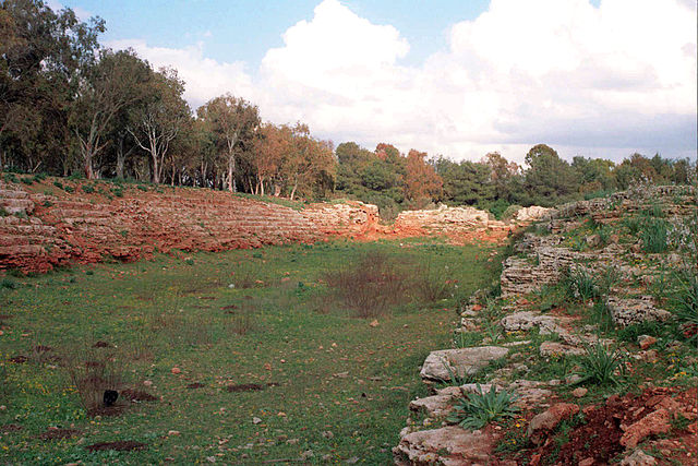
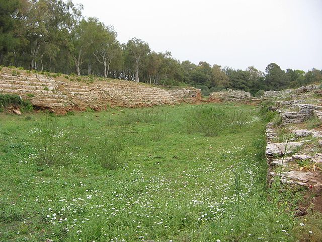
Stadium :
The Pre-Olympic Phoenician Stadium north of Amrit About 200 m (660 ft) northeast of the main temples of ancient Marathos and 180 m (590 ft) north of the Amrit Tell are the remains of a rock-carved Phoenician stadium. It is separated from the other two archaeological sites by the Nahr al-Amrit and a site called by the locals al-Meqla '(the quarry'). The Stadium of Amrit was first described in 1745 by Richard Pococke in Part 2 of his book, A Description of the East, and Some Other Countries, as the site where an ancient Circus was held. Ernest Renan examined it in 1860 and discussed it in his book Mission de Phénicie, making the conclusion that the complex was not Roman in its entirety and that the stadium was undoubtedly Phoenician. The stadium is about 225 to 230 meters long and 30 to 40 meters wide, it has similar dimensions to the stadium of Olympia in Greece (213 × 31/32 meters). Seven rows of seats have been partially preserved. The stadium was open to the west and had two entrances on the east side between seats. In addition, there was a tunnel to the interior. The stadium is located approximately at a right angle to the main temple of Amrit, the Maabed. The temples to the north and west have open sides or which the stadium forms a common intersection. It is believed that the Amrit stadium was the location for sacred competitions where anointing and funeral games took place. Labib Boutros, former director of athletics at the American University of Beirut has conducted recent studies of the stadium and suggested that its construction may date back as far as 1500 BC, saying that the Amrit stadium was "devoted to sports in Phoenicia several centuries before the Olympic Games".
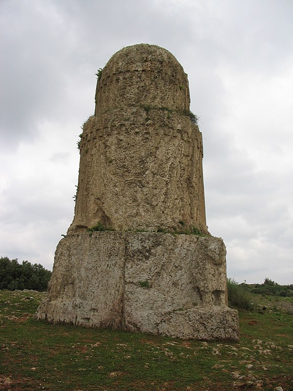
Necropolis :
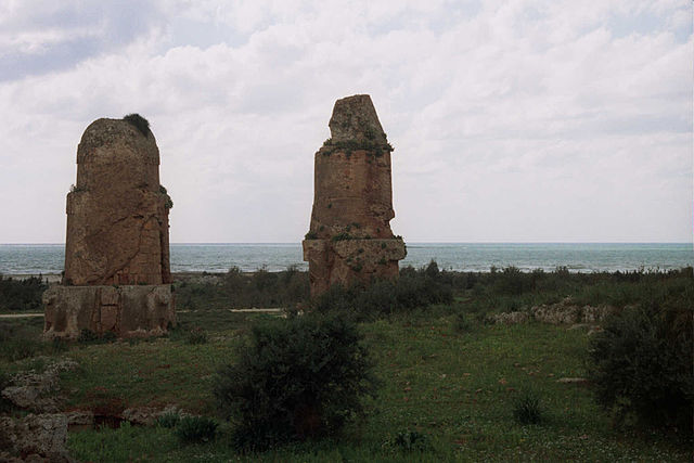
Burial towers at Amrit called "al Maghazil" or The Spindles The Necropolis in the south of Amrit consists of underground burial chambers and two distinguishing burial towers called by the locals "al Maghazil" or The Spindles that stand up to 7.5 m (25 ft) high. The larger tower is composed of a square stone base with a slightly upward tapering cylindrical block with a base diameter of 3.7 m (12 ft), rising to a pyramid as a top termination, which is badly damaged. The second is approximately 12 meters southeast and is not quite 7 m (23 ft) tall. At its base are three cylindrical parts whose diameters decrease and terminate in a dome. At the lower cylinder, to the corners of the square base plates, four lions decorate the building, which may not have been completed. Excavations of the burial chambers east of the towers has uncovered finds dated back as far as the 5th century BC. Plain limestone and clay sarcophagus were found arranged in cassette-like formation within the chambers. Other tombs are located south of the Nahr al-Qubli, the "al-Burg Bazzaq" or Worm tower, a phenomenal structure that was originally 19.50 meters high and the Hypogeum "Hagar al-Hubla" with three burial chambers, which were still used in Roman times.
Conservation
:
Gallery :
Meghazil tomb, Amrit in 2006
Phoenician Temple (Ma'abed), cella at the center of the court, Amrit in 2006
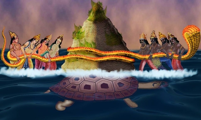
Phoenician Stadium, Amrit in 2006 Samudra Manthan (churning of sea) and Analysis of Dr. Gaurav A. Vyas :
Samudra Manthan (Churning of Sea) Aryan Scriptures such as Bhagavat Puran and Vishnu Puran mentions about Samudra Manthan i.e. churning of sea. In which Mount Mandara was used as the churning rod, and Vasuki, a nagaraj (king of snakes) who abides on Shiv's neck, became the churning rope. The Asurs holded the head of the snake, while the Devtas holded its tail. When the mountain was placed in the ocean, it began to sink. Vishnu, in the form of Kurma (lit. turtle), came to their rescue and supported the mountain on his shell.
In the churning of sea Amrit i.e. Nectar / Ambrosia came out of Sea which was taken by Devtas.
When we deeply analyse this story we find that Aryans and Maruts (Amorites / Amurru) were on one side and Asurs (Assyrians) were on other side and this place known as Amrit was won by Devtas i.e. Aryans and Maruts (Amorites / Amurru).
Above all this place Amrit is also located near Sea and was ruled by Aryans.
The snake and tortoise were worshipped by Chaldeans hence, there may be some role of them in this power struggle and they might have played neutral.
Source :
https://www.historyfiles.co.uk/
https://en.wikipedia.org/wiki/Amrit
|