| NUZI
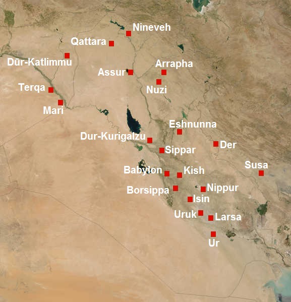
A map of Mesopotamia in 2nd millennium BC, showing Nineveh, Qattara (or Karana), Dur-Katlimmu, Assur, Arrapha, Terqa, Nuzi, Mari, Eshnunna, Dur-Kurigalzu, Der, Sippar, Babylon, Kish, Susa, Borsippa, Nippur, Isin, Uruk, Larsa and Ur, from north to south.
Nuzi (or Nuzu; Akkadian Gasur; modern Yorghan Tepe, Iraq) was an ancient Mesopotamian city southwest of the city of Arrapha (modern Kirkuk), located near the Tigris river. The site consists of one medium-sized multiperiod tell and two small single period mounds.
History
:
Archaeology
:
To date, around 5,000 tablets are known, mostly held at the Oriental Institute, the Harvard Semitic Museum and the Iraq Museum in Baghdad. Many are routine legal and business documents and about one quarter concern the business transactions of a single family. The vast majority of finds are from the Hurrian period during the second millennium BC with the remainder dating back to the town's founding during the Akkadian Empire. An archive contemporary to the Hurrian archive at Nuzi has been excavated from the "Green Palace" at the site of Tell al-Fakhar, 35 kilometres (22 mi) southwest of Nuzi.
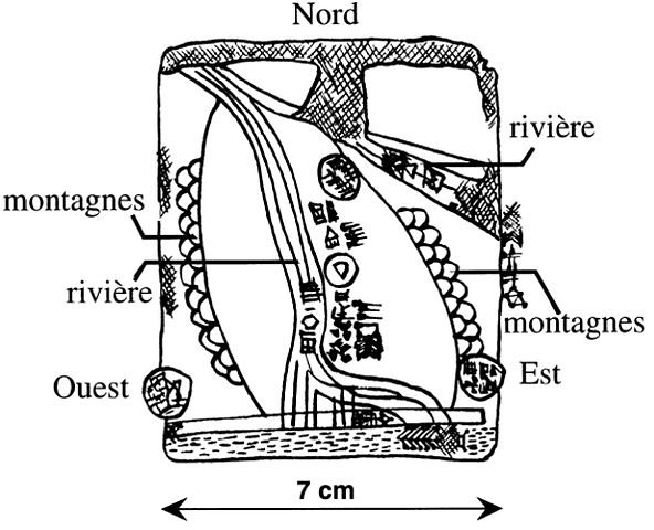
Sketch of the Nuzi map with French legends
Perhaps the most famous item found is the Nuzi map, which is the oldest known map ever discovered. It is unknown exactly what the Nuzi map charts, even though the majority of the tablet is preserved. The Nuzi map is actually one of the so-called Gasur texts, and predates the invasion of the city of Gasur by the Hurrians, who renamed it Nuzi. The cache of economic and business documents among which the map was found date to the Old Akkadian period (ca. 2360–2180 BC). Gasur was a thriving commercial center, and the texts reveal a varied business community with far reaching enterprises. It is possible that Ebla was a trading partner, and that the tablet, rather than a record of land-holdings, might indeed be a road map. The tablet, which is approximately 6 × 6.5 cm., is inscribed only on the obverse. It shows the city of Maskan-dur-ebla in the lower left corner, as well and a canal/river and two mountain ranges.
Nuzi,
a provincial town in the 14th century BC :
Administration
:
Archives that have been exhumed tell us about the royal family, as well as the organization of the internal administration of the palace and its dependencies, and the payments various workers received. Junior officers of the royal administration had such titles as sukkallu (often translated as "vizier", the second governor), "district manager" (halsuhlu), and "mayor" (hazannu). Justice was rendered by these officers, but also by judges (dayanu) installed in the districts.
Free subjects of the state were liable to a charge, the Ilku, which consisted of a requirement to perform various types of military and civilian services, such as working the land.
Source :
https://en.wikipedia.org/ |