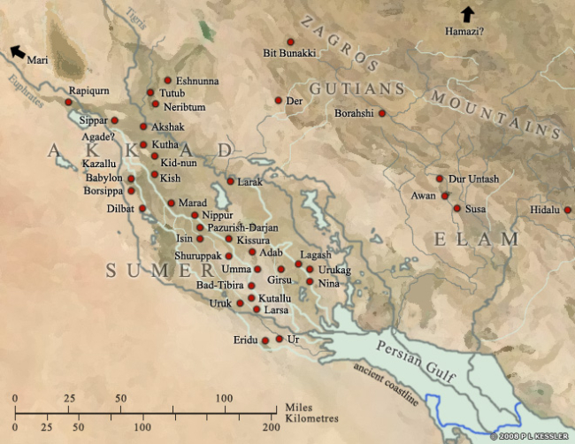
| SUMER General Map of Sumer :
The area which formed Sumer started at the Persian Gulf and reached north to the 'neck' of Mesopotamia where the two rivers, the Tigris and the Euphrates meander much closer to each other. To the east loomed the Zagros Mountains, where scattered city states thrived on trade and learning from Sumer, and to the west was the vast expanse of the Arabian desert.
The rivers have changed course considerably in the last four thousand years, moving well away from some of the cities and causing the complex network of canals to dry up. At the time, the two rivers had separate entrances into the foreshortened Gulf.
Some of the earliest cities, such as Sippar, Borsippa, and Kish in the north, and Ur, Uruk, and Eridu in the south, formed the endpoints of what became that complex network of cities and canals. Girsu and Nippur were highly important religious centres but other cities, such as Larsa, Eshnunna, Babylon, and Isin did not really emerge as such until after the end of Sumerian civilisation circa 2000 BC.
|