| KASHMIR VALLEY
Kashmir valley seen from a satellite. Snow-capped peaks of the Pir Panjal Range (left in the image; southwest in compass) and the Himalayas (right in image; northeast in compass) flank the valley
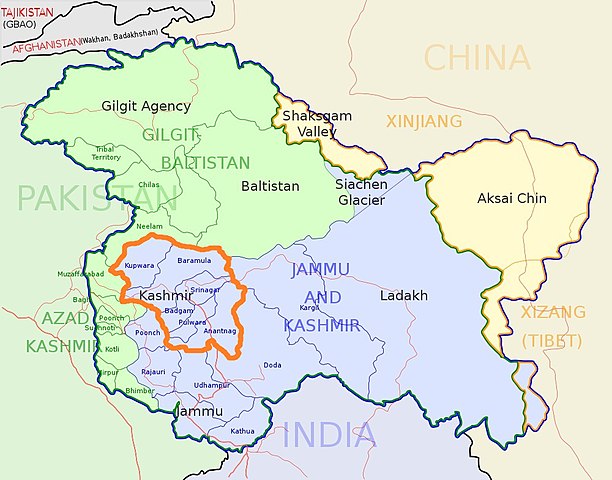
Kashmir Division (bordered orange) shown within the wider Kashmir region Kashmir Valley
Administrative Division
Country : India
Union territory : Jammu and Kashmir
Districts : Anantnag, Baramulla, Budgam, Bandipore, Ganderbal, Kupwara, Kulgam, Pulwama, Shopian and Srinagar.
Headquarters
: Srinagar
Historical divisions : Kamraz (North Kashmir), Yamraz (Central Kashmir) and Maraz ( South Kashmir)
Government
• Type : Division
• Divisional Commissioner : Pandurang Kondbarao Pole
Area
• Total : 15,948 km2 (6,158 sq mi)
Dimensions
• Length : 135 km (83.885 mi)
• Width : 32 km (19.884 mi)
Elevation : 1,620 m (5,314 ft)
Population (2011)
• Total : 6,907,622
• Density : 450.06/km2 (1,165.7/sq mi)
Demonym(s) : Kashmiris, Koshur
Ethnicity and language
• Languages : Kashmiri, Urdu, Hindi, English, Pahari people (Kashmir), Gojri, Shina
• Religions : 97.16% Islam, 1.84% Hinduism, 0.88% Sikhism, 0.11% Buddhism
Time zone : UTC+5:30 (IST)
Vehicle registration : JK
Highest peak : Machoi Peak (5458 metres)
Largest lake : Wular lake (260 km2 (100 sq mi))
Longest
river : Jhelum river(725 kilometres)
The Kashmir Valley, also known as the Vale of Kashmir, is an intermontane valley in the portion of the Kashmir region administered by India. The valley is bounded on the southwest by the Pir Panjal Range and on the northeast by the main Himalayas range. It is approximately 135 km (84 mi) long and 32 km (20 mi) wide, and drained by the Jhelum River.
The Kashmir Division is a revenue and administrative division of Indian-administered Jammu and Kashmir. The Kashmir division borders Jammu Division to the south and Ladakh to the east while Line of Control forms its northern and the western border. The division consists of the following districts: Anantnag, Baramulla, Budgam, Bandipore, Ganderbal, Kupwara, Kulgam, Pulwama, Shopian and Srinagar.
Srinagar is its main city and also the summer capital of the Jammu and Kashmir. Other main cities are Baramulla, Anantnag, Pulwama.
Climate :
Kashmir Valley has a moderate climate, which is largely defined by its geographic location, with the towering Karakoram Range in the north, Pir Panjal Range in the south and west and Zanskar Range in the east. It can be generally described as cool in the spring and autumn, mild in the summer and cold in the winter. As a large valley with significant differences in geo-location among various districts, the weather is often cooler in the hilly areas compared to the flat lower part.
Summer is usually mild and fairly dry, but relative humidity is generally high and the nights are cool. The precipitation occurs throughout the year and no month is particularly dry. The hottest month is July (mean minimum temperature 16 °C, mean maximum temperature 32 °C) and the coldest are December–January (mean minimum temperature -15 °C, mean maximum temperature 0 °C).
Compared with other plain parts of India, Kashmir valley enjoys a more moderate climate but weather conditions are unpredictable. The recorded high temperature is 33 °C and the recorded low is -18 °C. On 5 and 6 January 2012, after years of relatively little snow, a wave of heavy snow and low temperatures (winter storm) shocked the valley covering it in a thick layer of snow and ice.
Kashmir Valley has seen an increase in relative humidity and annual precipitation in the last few years. This is most likely because of the commercial afforestation projects which also include expanding parks and green cover.
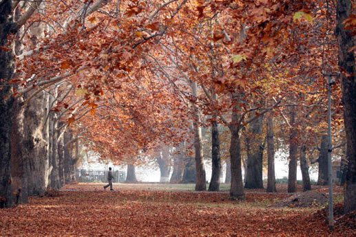
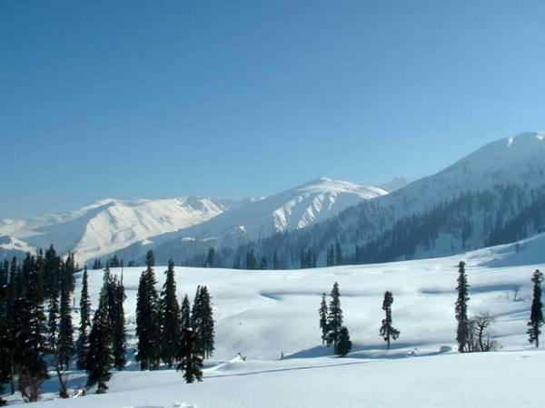
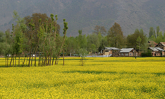
Different seasons and climatic conditions in Kashmir :
Autumn
Winter
Spring
Summer Transport
:
Srinagar Airport (SXR) is the main airport in Kashmir valley and has scheduled flights from Jammu, Leh, Mumbai, Chandigarh and New Delhi. Kashmir valley has a 119 km (74 mi) long modern railway line that started in October 2009 and connects Baramulla in the western part of the valley to Srinagar and Qazigund. It further links the Kashmir Valley to Banihal across the Pir Panjal mountains through the new 11.215 km (6.969 mi) long Pir Panjal Railway Tunnel or Banihal rail tunnel from 26 June 2013. Banihal railway station will be linked to the rest of India in another few years as the construction of the railway line from Jammu to Banihal progresses steadily. Transport within the valley is predominantly by road. Other airports are in Udhampur, Leh and Jammu. Another airport is proposed in Anantnag.
Source :
https://en.wikipedia.org/ |