| SATTAGYDIA
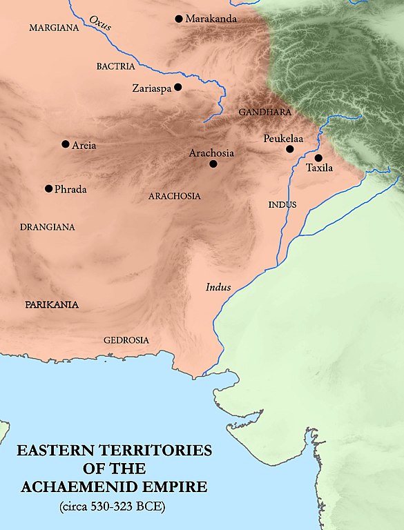
Eastern territories of the Achaemenid Empire, including Sattagydia, next to Gandara and the territory of the Indus
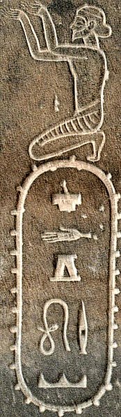
Sattagydia, on the Egyptian Statue of Darius I Sattagydian Achaemenid soldier
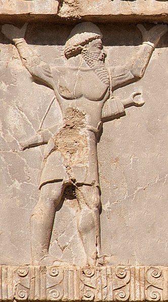
Xerxes I tomb, Sattagydian soldier of the Achaemenid army, circa 480 BCE
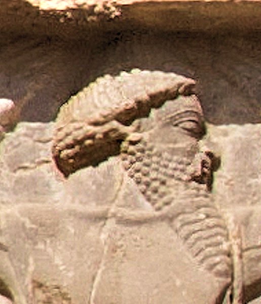
Xerxes I tomb, Sattagydian soldier circa 480 BCE (detail)
The name for Sattagydia (Thataguš) in the DNa inscription of Darius I Sattagydia (Old Persian: Thataguš, country of the "hundred cows") was one of the easternmost regions of the Achaemenid Empire, part of its Seventh tax district according to Herodotus, along with Gandarae, Dadicae and Aparytae. It is believed to have been situated east of the Sulaiman Mountains up to the Indus River in the basin around Bannu.
Geography
:
Following recent archaeological findings, the Bannu basin has become the favoured choice. David Fleming points out that it is close to Kurram and Tochi rivers and it has four routes to the west, via the Khyber Pass, the Kurram river valley, the Gomal Pass and the Bolan Pass in Balochistan. Magee et al. have reported findings of recent archaeological excavations at Akra, noting that it was a large urban site that existed throughout the Iron Age and had trade relations with Central Asia.
History
:
After being conquered by Alexander the Great, Sattagydia became part of the Seleucid Empire. Under the Seleucids this area was adjacent to Sind, which was itself adjacent to Abiria (corresponding roughly to Rajasthan), with the coastal region being called Syrastrene. The area was taken from the Seleucids by the Mauryans under Chandragupta in 316 BCE. [need quotation to verify] And, beginning in the 1st century BC, the area was incorporated into the burgeoning Kushan empire, referred to as "Scythia" in the Periplus.
Source :
https://en.wikipedia.org/ |